Image: Google Map Standard View
1 media/Google Map standard view2_thumb.jpg 2020-08-21T12:28:53+00:00 Jennifer Fraser 404477000adfd4e5c7a1128cfac82e1fc740e8c3 2 1 Google Map Standard View plain 2020-08-21T12:28:53+00:00 Jennifer Fraser 404477000adfd4e5c7a1128cfac82e1fc740e8c3This page is referenced by:
-
1
media/Image_Singgalang from ISI.jpeg
2020-08-21T12:05:02+00:00
Introduction to Place
12
Introduction to Place
image_header
2022-02-08T03:45:06+00:00
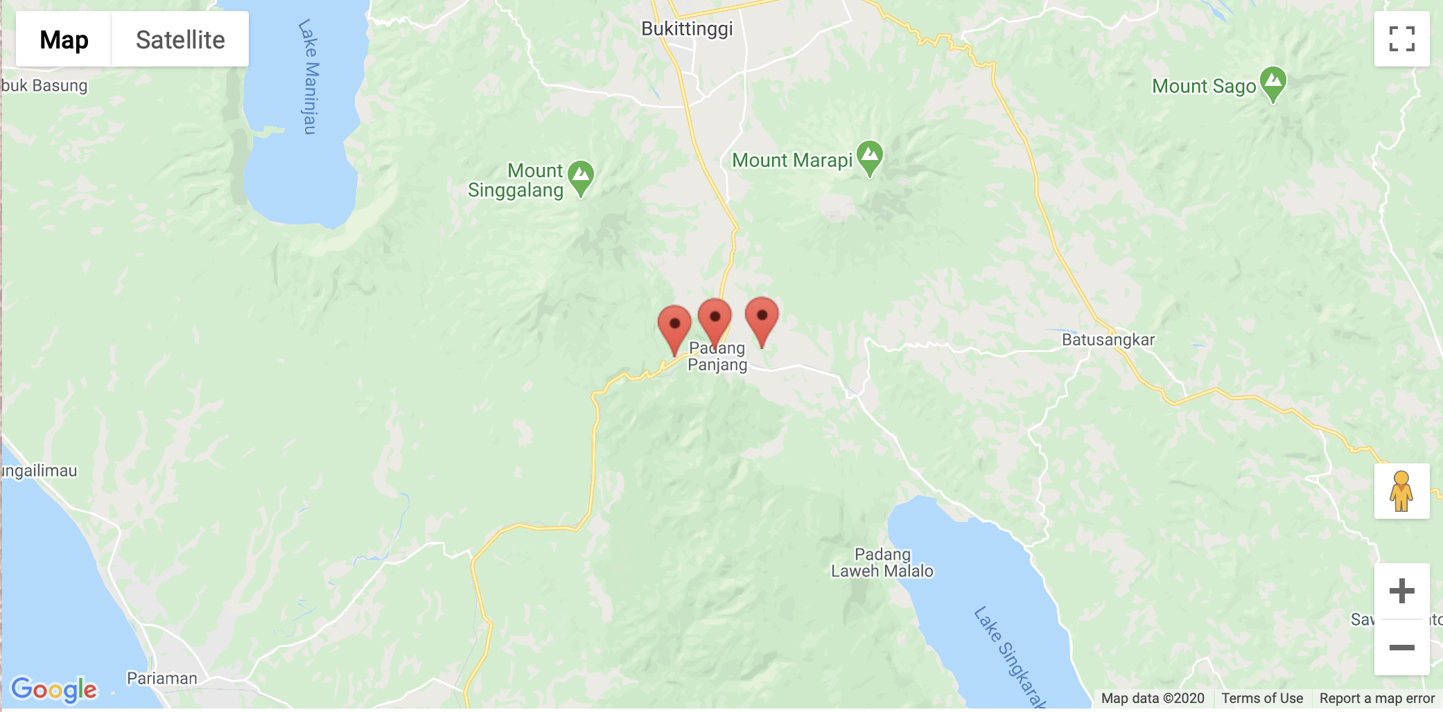
Place--where one is situated, where one lives, works and travels--governs people's experience. Much of my time in the highlands of West Sumatra has been spent in the highland town of Padang Panjang, surrounded by the peaks of Mt. Tandikek and Mt. Singgalang to the northeast and Mt. Marapi to the northwest. Often, those mountains were covered in cloud, but when the peaks were revealed, I reveled in their beauty. Many Minangkabau people experience these mountains on a regular basis but their experiences are likely structured by different views, such as living in Koto Baru directly between them or in Bukittinggi where they are located to the south. My experience, my knowledge of Mt. Singgalang is specific to my location.
The experience of place in West Sumatra, as anywhere, is condition by personal experience, collection of places lived or traveled over a lifetime, the visits to see people or performances located in specific places, and the roads traveled to get there.
To help you, the user, get a sense of the place where this music lives, we've provided several tools.- The first is two-dimensional maps that present a sense of the boundedness of places, where one places begins and another ends.
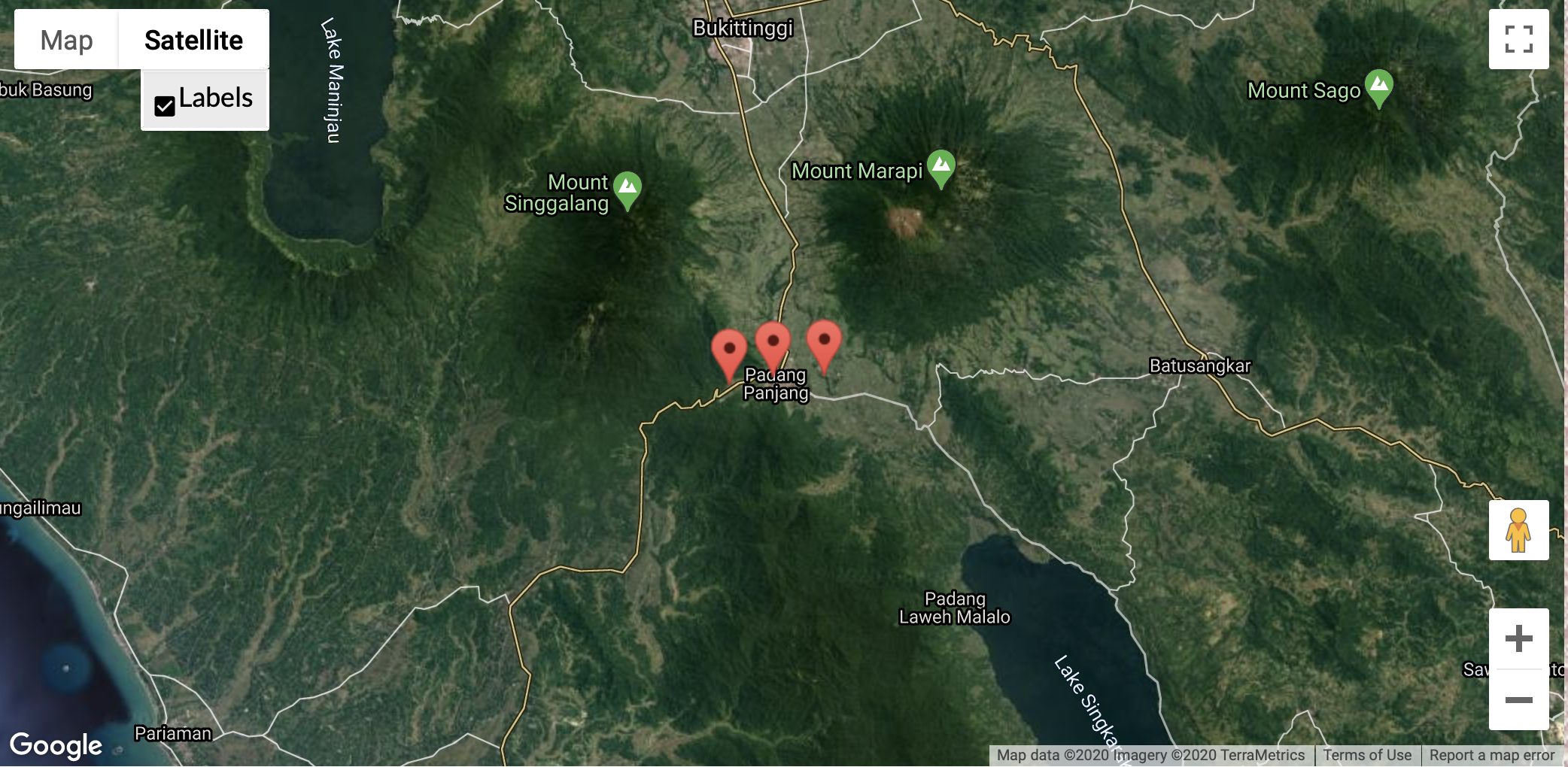
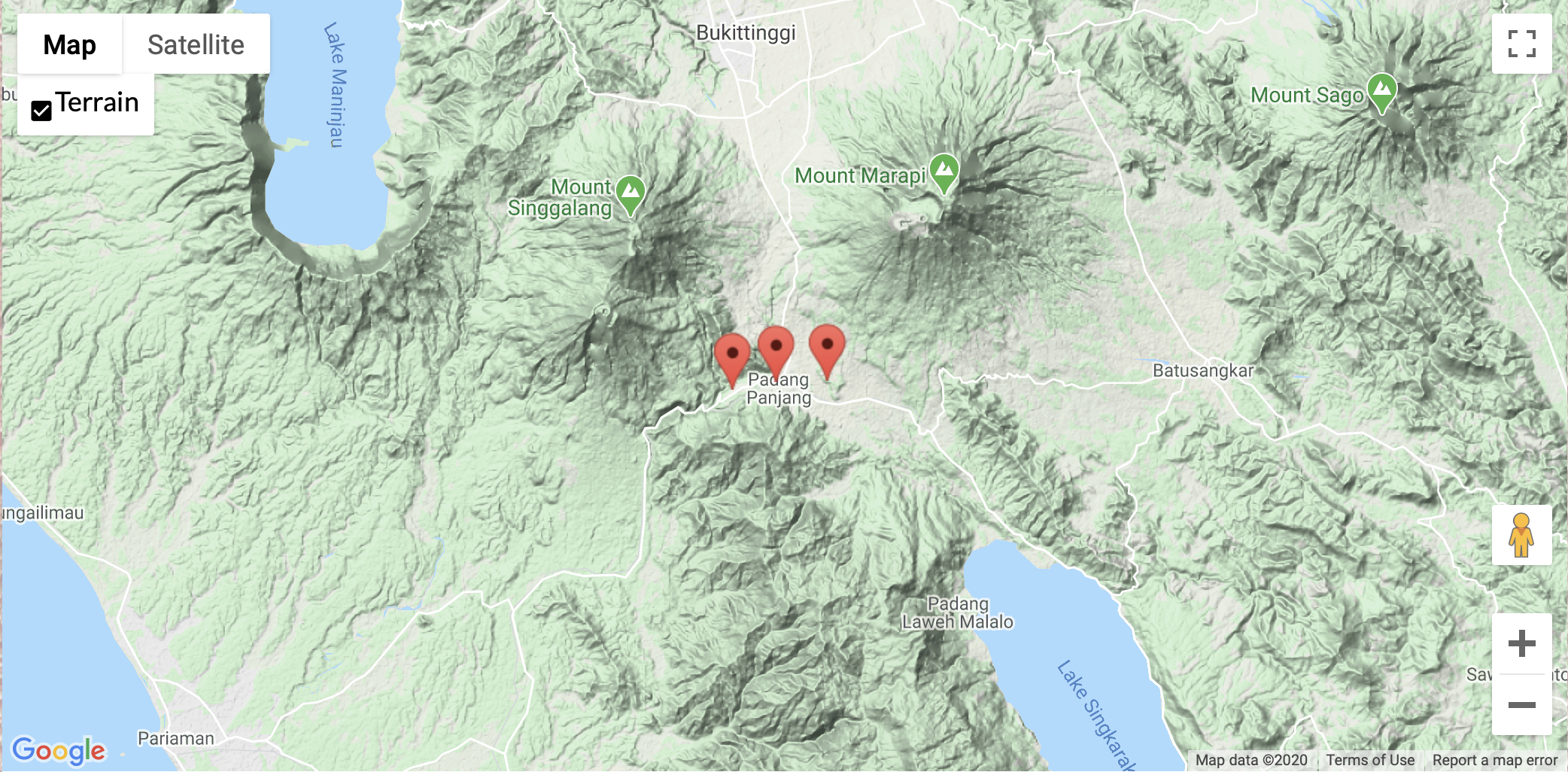
- The second is interactive google maps where you, as the user, can choose your view. You can zoom in or out, to see where a named place is situated. You can choose your view, toggling between "Map" and "Satellite" views, between "Streetview" and "Terrain" within maps, and with and without labels in "Satellite" view. My personal favorite is "Terrain" view because it gives you the best sense of the lay of the land, of the topography, which in the mountainous highlands is really important.
- The third is images of places, where possible. We've opted to use images where authorship has been guaranteed, either my own or from family and friends who have traveled to experience this place I've called home. When you click on the page for a place, any associated images will be included there. For example, click on the link to go to the page for Padang Panjang, the place at the center of the google maps above.